
The Licking County Bicycle and Pedestrian Transportation Corridor, donated by the Thomas J. Evans Foundation, received the the 1997 "Way-to-go" Award from the Environmental Protection Agency for its impact in reducing air pollutants.
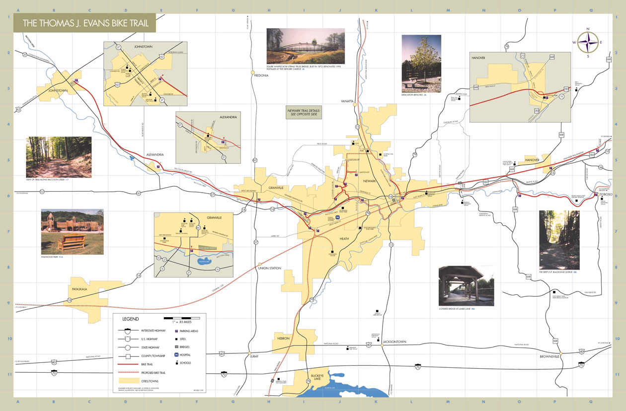
Click here to view a map of the Licking County Trail System (Please be cautioned that these files are large!)
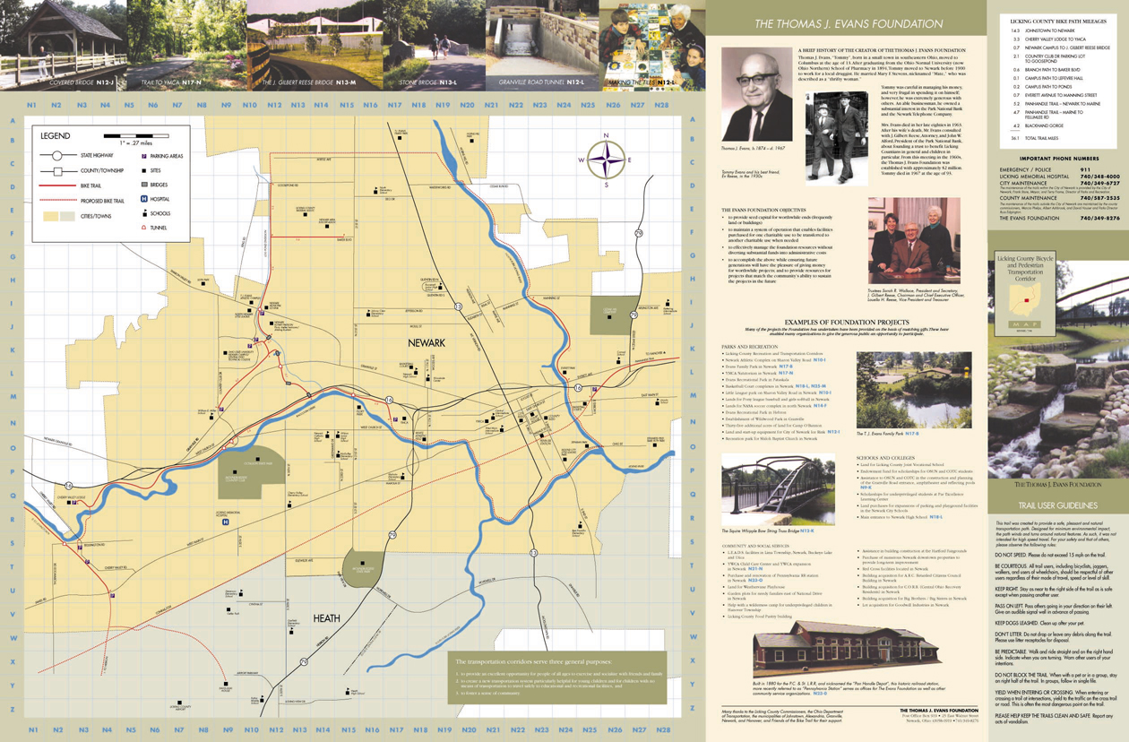
Click here to view a map of the Trail System in the Newark Area (Please be cautioned that these files are large!)
If you would like to receive a copy of these maps, or other information relating to the trail system please e-mail your request tojbriddel@msmisp.com
We have completed over forty miles of eight to ten foot wide asphalt bicycle and pedestrian trail in Licking and Clinton Counties, OH. These trails provide an opportunity for people to exercise and socialize with friends and family.


This stretch of trail is part of the Rails to Trial network which is part of the "Ohio River to Lake Erie Trail System." The Panhandle Trail extends east of Newark, Ohio and will eventually be extended thru Muskingum and Coshocton Counties, Ohio.

The Panhandle Trail shares the right-of-way of an active railroad bed. These Rails-to-Trails paths are safer than using the streets or highways. A recent survey by the Rails to Trails Conservancy found that during the last 30 years there has been only one minor accident on the nearly 40 trails running alongside active railroads.

Trails are designed with a minimum impact on the surrounding environment.